GIS
Bike Wayfinding Inventory at PDX
for Port of Portland, 2024
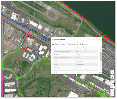
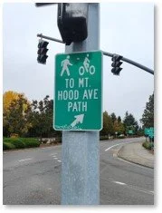
In responding to rider concerns about wayfinding difficulties at PDX, I rode 14 miles of bike lanes, paths, roads and sidewalks to inventory every wayfinding sign at PDX aimed at bike riders.
I aggregated my findings in a web map, with links to a photo of every sign (internal to the Port only). The data indicates there are 72 different signs on PDX property, covering 26 different sign typologies. Now Port staff can quickly pull up details on a sign without having to traverse the nearly 3,000 acres of property PDX sits on.


Presented

Web-based

User-friendly
Reusable